Methodology
The main reference for the methodology of the PaHisCat project is the methodology used in English Historical Landscape Characterisation, although it is not followed in detail.
One of PaHisCat’s methodological peculiarities is that fact that it studies and dates plots (fields, orchards, scrublands, woodlands, pastures, urbanised and industrial areas), linear realities (paths, irrigation channels, boundaries) and point realities (country homes, towns, buildings, dig sites, etc.). Over the course of the centuries, the lines and points have been very important in organising plots and the entire landscape in some areas. In the past, components that are just a point on the map, like a church or a castle, for example, generated new landscapes in the surrounding area.
PaHisCat presents the changes visited upon the Catalan landscapes throughout recent decades and centuries, many of which are explained in the Mediaeval and Roman eras. In some Catalan comarques (counties), the changes that occurred during the centuries of Roman dominion were very profound and have greatly influenced the land to the present day. And yet, we cannot forget the prehistoric precedents or the great transformations that have occurred in modern times and during the last 50 years of the 20th century.
PaHisCat does not provide a mere inventory of components of historic interest found in the aforementioned landscapes, but formulates a reading of those sets of components that provide landscape explanation from a historical perspective.

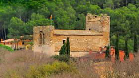
Point components are castles, churches, country homes and each house in a village or an industrial building. All these components have generated changes in other components of the landscape. Even if they are only points on a map, they cannot be underestimated when creating historic cartography. To understand a town, one must know just which component generated it (a castle, a church, houses, a market, etc.). Sometimes, to understand how a region is organised, it is very important to understand the effects of a church, castle or market.

Linear components are paths, irrigation canals and boundaries of all kinds. These components have easily been transformed by point components and have been able to change their surroundings at the same time, creating new point or linear components or organising nearby plots. The effects that an important and ‘old’ path has had on the land over the course of the centuries are always surprising and noticeable. Other paths and many field plot boundaries are often found alongside or follow its same orientation. Thus, the creation of an irrigation canal, whether in the Islamic era or the 20th century, has always entailed profound reorganisation of the space it serves. In some comarques of Catalonia, the analysis of hydraulic areas is very important.

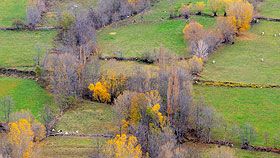
Fields, woods, pastures and irrigated areas are plots, which have boundaries. Very often, linear and point components can be dated easily. Fields often need to be dated in relation to an inhabited place, where the people who worked them lived, or in relation to a path, a cattle trail or track, an irrigation canal or a limit. These plots can certainly be devoted to other activities, such as an urbanised space, an industrial estate, or a recreation area, or dedicated to military activities, an area covered with water, etc.
Study of the characteristics of the elements and of the plots that can be grouped (if they have the same function) to form landscape components helps us to understand that different types of historic landscape exist. For example, the way that the elements and plots around Lleida are organised is not the same as that found in Cerdanya or in the vicinity of Girona. Each region or territorial area has one or various types of historic landscape. In addition to other aspects, the PaHisCat project attempts to analyse them based on the transformations that have occurred throughout history.