Presentation
PaHisCat is a pilot project on the evolution of landscape. It aims to decipher and diffuse traces of the past that are visible in four different landscapes in Catalonia. It also aims to provide guidelines on territorial, patrimonial and sectoral planning.
PaHisCat complements the results of landscape catalogues in Catalonia in terms of historical background and it has been developed with the Historic Landscape Research Group of the University of Lleida.
The study
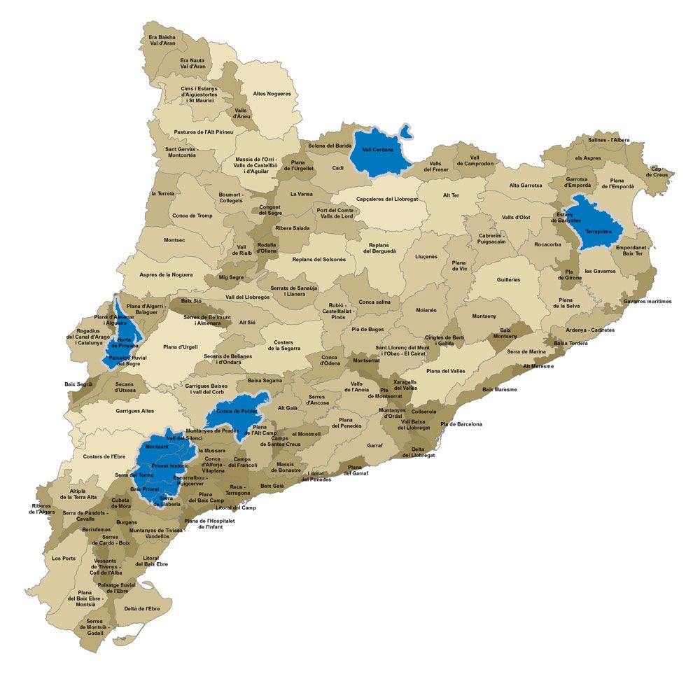
PaHisCat studies the past in order to better plan for the future. PaHisCat is a pilot project about the historic evolution of the landscape that aims to identify, document, map and disseminate the traces of the past (paths, plots, country homes, canals, etc.) that are visible in four of the 134 contemporary landscapes in Catalonia, defined through the landscape catalogues, as well as to provide patterns for spatial and sectorial planning from a landscape protection, management and planning perspective. These four landscapes are Horta de Pinyana, Conca de Poblet, Terraprims and Vall Cerdana. The PaHisCat project has been developed as the result of collaboration between the History Department of the University of Lleida and the Landscape Observatory.
In 2015, PaHisCat was applied to El Priorat region with the support of Tarragona Regional Council, as the core document for the “Priorat-Montsant-Siurana, Mediterranean Mountain Agricultural Landscape” candidature for UNESCO’s World Heritage.

Purposes
The main objectives pursued by PaHisCat include:
- To contribute to understanding the landscape as a reality formed over the course of centuries, by the different generations that have lived in each place.
- To provide a tool for spatial management and planning in the area.
- To become management and planning tool for professionals working on landscape, land and heritage-related projects.
- To acquire information that helps to give more value to the land as heritage.
- To provide knowledge about the changes visited upon the land over various eras of our past, and to be able to learn about the history of Catalonia through the landscape.
- To contribute to developing a historic landscape characterisation methodology that can serve as a basis for other future projects.
PaHisCat is a historical research project serving all institutions and individuals that can make use of it or that are interested in learning about the history of the landscapes of Catalonia. PaHisCat is intended to be a reference from which to encourage similar projects in other parts of the region.
What else can PaHisCat do?
Here are some of the things that PaHisCat can make possible:
- Relate settled sites and dig sites with a landscape of the past that can be dated and mostly understood.
- Situate a very large percentage of paths in a period in the past and simultaneously ensure that they have been used over the course of many centuries and by many generations prior to the present day.
- Ensure that many fields present in current landscapes have been worked generation after generation and already existed at least two thousand years ago.Date irrigation channels and hydraulic systems that still exist today.
- Mutually relate elements of the landscape, which allows us to date paths, fields, irrigation channels, settled sites, etc.
- Better understand the meaning of the toponyms, as the toponyms become one more element of this historic landscape.
- Relate the landscape with the societies that have lived there in every chapter of history. The landscape is the sum of inheritance and new needs that have been created in every past era.
The PaHisCat team) is led by Jordi Bolós, Chair of Mediaeval History at the University of Lleida, under the coordination of the Landscape Observatory of Catalonia.
The team has a large number of university and external collaborators and is formed by historians, geographers, archivists and experts in geographic information systems.